Cleveland 19 News declared a First Alert Weather Day for Northeast Ohio on June 14, 2026, warning residents of a significant threat of severe storms this afternoon and into the early evening hours. The alert covers the Greater Cleveland area and surrounding communities across the region.
The non-obvious detail most people may miss: First Alert Weather Days are not issued for every storm — meteorologists at Cleveland 19 reserve the designation specifically for events that carry a higher-than-normal risk of dangerous conditions, meaning this is a step above a routine rain advisory.
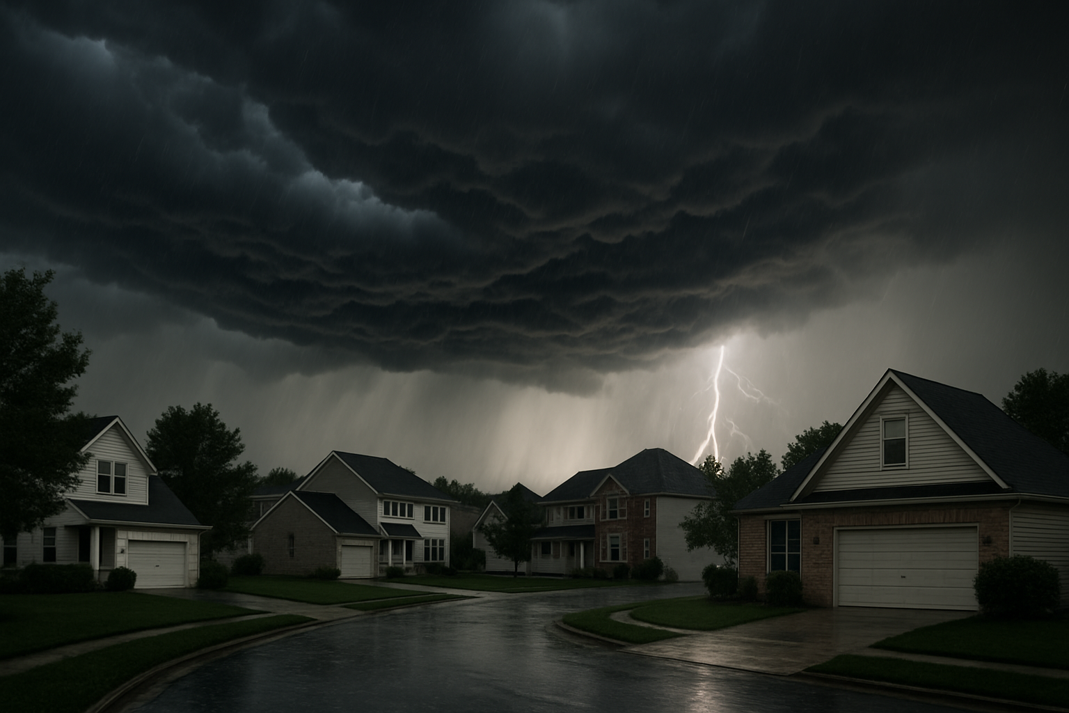
What Severe Storms Ohio Residents Should Expect
The primary threats tied to this system include damaging wind gusts, large hail, and the possibility of isolated tornadoes. Heavy rainfall could also cause localized flash flooding, particularly in low-lying areas and near drainage systems already saturated from earlier June rain events.
The window of greatest risk runs from mid-afternoon through the early evening, roughly between 2 p.m. and 8 p.m. local time. Meteorologists note that storm activity could be fast-moving, meaning conditions can deteriorate quickly with little warning on the ground.
Why This System Is More Dangerous Than a Typical June Storm
A combination of factors is making this outbreak more potent than the average summer thunderstorm. A warm, humid airmass has been building over the Ohio Valley for several days, loading the atmosphere with instability. A fast-moving cold front is expected to slam into that moisture, triggering a line of strong to severe thunderstorms that could organize rapidly.
The Storm Prediction Center, a division of NOAA, monitors exactly these kinds of setups. When a cold front interacts with a deeply unstable boundary layer, the result is often a squall line capable of producing widespread wind damage — even in the absence of a full tornado. Northeast Ohio’s flat lake-plain terrain offers little natural resistance to such systems.
How to Prepare Before the Storms Arrive
Emergency management officials generally recommend the following steps ahead of a severe weather outlook like this one:
- Charge your devices now. Power outages are common during high-wind events, and a charged phone is your primary lifeline for weather alerts.
- Bring in outdoor furniture and loose items. Even moderate wind gusts can turn lawn chairs and decorations into projectiles.
- Identify your shelter spot. Interior rooms on the lowest floor, away from windows, provide the best protection during a tornado warning.
- Download a weather alert app. Apps tied to the National Weather Service push Wireless Emergency Alerts directly to your phone when a warning is issued for your exact location.
- Avoid driving during peak storm hours. Most storm-related fatalities in Ohio occur in vehicles, not in homes.
What to Do When a Warning Is Issued
There is a critical difference between a watch and a warning that many people still confuse. A tornado or severe thunderstorm watch means conditions are favorable for severe weather to develop — stay alert, but you don’t need to take shelter yet. A warning means a storm has been confirmed by radar or a spotter and is imminent or occurring — take shelter immediately.
If you’re outdoors and hear thunder, head inside. The “30-30 rule” is a useful benchmark: if the time between a lightning flash and the thunder clap is 30 seconds or less, seek shelter and stay inside for at least 30 minutes after the last rumble.
Lake Erie’s Role in Northeast Ohio Storms
Northeast Ohio sits in a unique meteorological zone influenced by Lake Erie. While the lake can sometimes weaken systems approaching from the west in winter, in summer it often adds moisture and instability to already-charged storm cells. This lake-effect enhancement can intensify rainfall totals and extend a storm’s duration longer than inland areas experience.
Cleveland and its eastern suburbs — including Euclid, Mentor, and Painesville — are particularly exposed to this dynamic, and residents there should monitor conditions especially closely this afternoon.
Power Outages and Recovery Timeline
FirstEnergy, the primary utility serving much of Northeast Ohio, typically pre-positions repair crews ahead of significant severe weather events. Even so, widespread outages from a derecho-style wind event can take 24 to 72 hours to fully restore, depending on the extent of tree and line damage.
If you lose power, report the outage directly through your utility’s app or website so crews can map the affected zones faster. Do not approach downed power lines under any circumstances — treat every downed wire as live.
Cleveland 19’s meteorology team is expected to provide rolling updates through the afternoon. Keep an eye on local broadcasts and push alerts as the storm window approaches. Conditions could change quickly, and the exact track of the most intense cells will only become clear in real time.
For more on how energy infrastructure holds up under extreme weather pressure, see our look at how Cushing oil inventory is already under strain — another sign that summer 2026 is testing the country’s infrastructure on multiple fronts.